Watershed Map Project
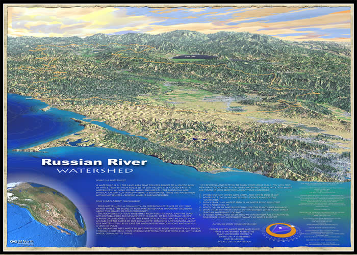
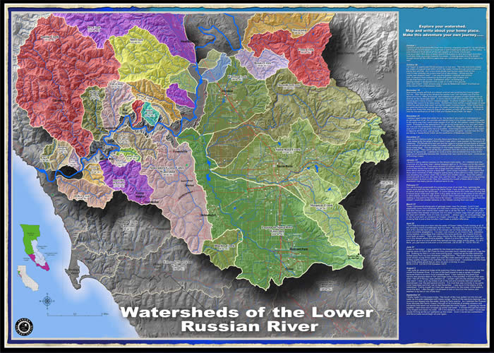
This watershed map was delivered to over 900 Sonoma County classrooms in the spring of 2006. The map is two-sided, with a perspective view of the Russian River basin and planned view of sub-watersheds of the lower Russian River.
David Berman collaboratively designed the map. The Sonoma Ecology Center assisted with the planned view (sub-watersheds). Justin Boe wrote the journal entries of the seasonal explorations journeying down the watershed. David Osti, a cartographer from 34 North, created the final layout and perspective side of the map. The Watershed Map Project was funded to the schools by a grant from the City of Santa Rosa. The actual map is 28” x 20”. It is printed by Greener Printing, on recycled paper ( New Leaf Paper ) with soy based inks.
To purchase a map contact: David Berman via email. Click here for a PDF closer view of the watershed map Watershed Map perspective view Watershed Map planned view (sub-watersheds of the lower Russian River Basin) Watersheds of the Lower Russian River (planned view)
|
Perspective view